Landsat 8 data now available for free
Posted by administrator on June 5, 2013
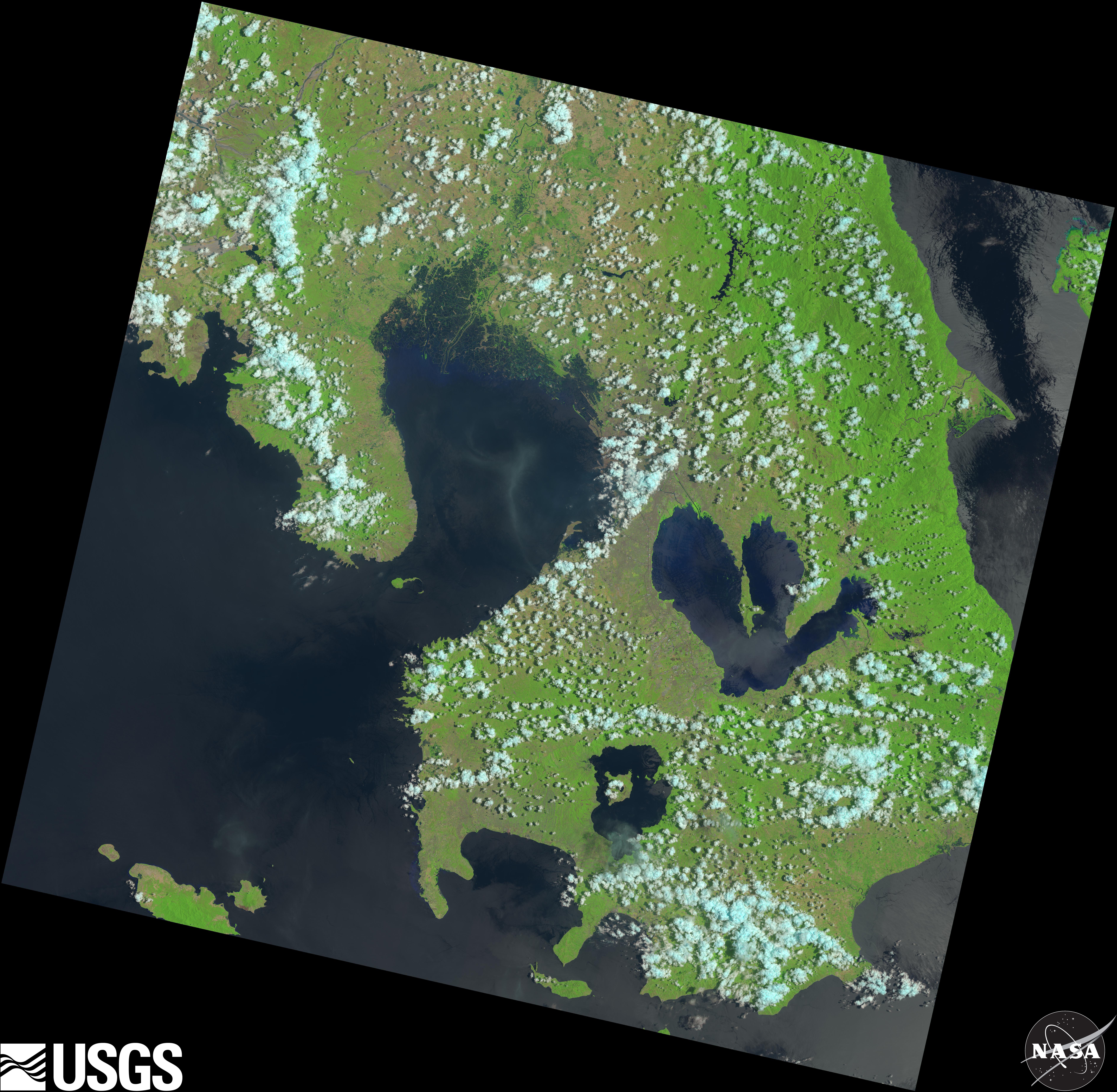
Landsat 8 image of Metro Manila and adjoining areas (including Taal and Laguna Lakes, and Manila Bay). Image taken by the Operational Land Imager (OLI) on May 13, 2013.
(Reposted from http://landsat.usgs.gov/LDCM_Landsat8.php)

The Landsat 8 satellite.
Data collected by the Operational Land Imager (OLI) and the Thermal Infrared Sensor (TIRS) onboard the Landsat 8 satellite are available to download at no charge from GloVis, EarthExplorer, or via the LandsatLook Viewer.
Orbiting the Earth every 99 minutes, Landsat 8 images the entire Earth every 16 days in the same orbit previously used by Landsat 5. Data products are available within 12 hours of reception.
Landsat 8 Data Products
OLI and TIRS data from Landsat 8 is processed to be consistent with the already archived Landsat 1 through 7 data products. Processing details of Landsat 8 Level 1 Products are described on http://landsat.usgs.gov/LDCM_DataProduct.php
The OLI sensor includes refined heritage bands, along with two new band files, and a new Quality Assessment band file. The TIRS sensor provides two thermal bands. Band names, wavelengths and resolution for each sensor are listed on http://landsat.usgs.gov/band_designations_landsat_satellites.php. A comparison of Landsat 8 and Landsat 7 band file combinations and wavelength values is available at http://landsat.usgs.gov/L8_band_combos.php. The additional bands will create a larger data file size, at approximately 1 GB compressed.
Landsat 8’s OLI and TIRS sensors provide improved signal-to-noise (SNR) radiometric performance quantized over a 12-bit dynamic range. This translates into 4096 potential grey levels in an image compared with only 256 grey levels in previous 8-bit instruments. Improved signal to noise performance will enable improved characterization of land cover state and condition. Products will be delivered as 16-bit images.

Leave a comment